
“Now is no time to think of what you do not have. Think of what you can do with what there is” – Ernest Hemingway, The Old Man and the Sea
Due to Scotland being part of an Island its mostly surrounded by ocean. The coastline of Scotland is vast and beautiful and it directly supports the Scottish lifestyle and culture.
As lockdown continues March and April has saw us spend some time around our local coast. Due to travel restrictions still being in place we have looked for alternative things to do or simply had more time to do the alternative. One bonus from lockdown I guess!
I very much enjoy being around the sea and find it calming, simply listening to the sound of the ocean is one of my favourite things to do.
Whilst exploring different parts of Fife’s coastline we came up with an idea and decided to set ourselves a challenge whilst still in lockdown…why not walk the whole of Fife’s Coastal Path continuosly over a long weekend….I mean, why wouldn’t you!
Fife’s Coastal Path stretches from Kincardine all the way to Newburgh (it used to stop at the Tay Bridge). Officially they say it is 117 miles long we did 125 miles but I’ll come back to that one later on!
So our idea was to do it over a long weekend Thursday to Monday. Starting weekdays as soon after work as we could and weekends meant we would be up and away early, finishing late in order to complete it over the 5 days we set ourselves as the challenge…so basically we were trying to undertake as much miles over the weekend as possible so less needed to be done evenings.
We also planned on encompassing shuttle runs so we would leave one car at the starting point of each day and the other at a realistic finish point, starting from the same finishing point each new day so no ‘cheating’ could take place. These shuttle runs did however add extra time onto days making them very long indeed… but it was all part of the challenge and we do like a challenge.
Challenges are important for all of us, I live for these kind of things and on completion there is sometimes no better feeling. Adventure is where I like to try and conquer whatever it is I have set for my challenge, which is unique to me and therefore can only be measured by me. The past year saw us having to redefine our ‘adventures’ but they were there all the same and have kept us going.
After arriving in Kincardine we were off. It felt quite exciting and I was happy to once again be undertaking a long distance hike.
I love to walk. I love the simplicity of it, putting one foot in front of the other, again and again and again in order to get to an end point. Just you against the elements…there’s something therapeutic to it.
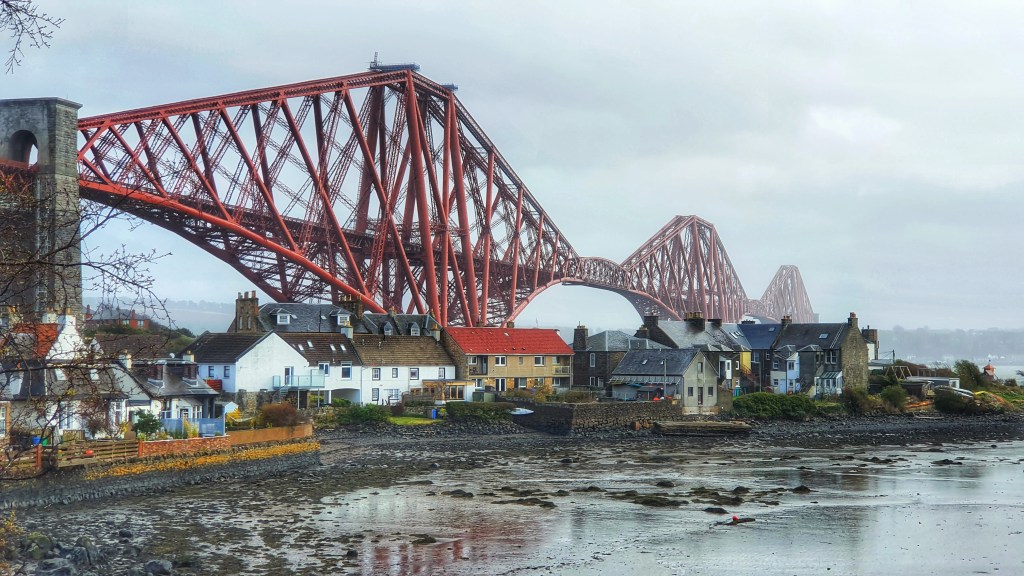
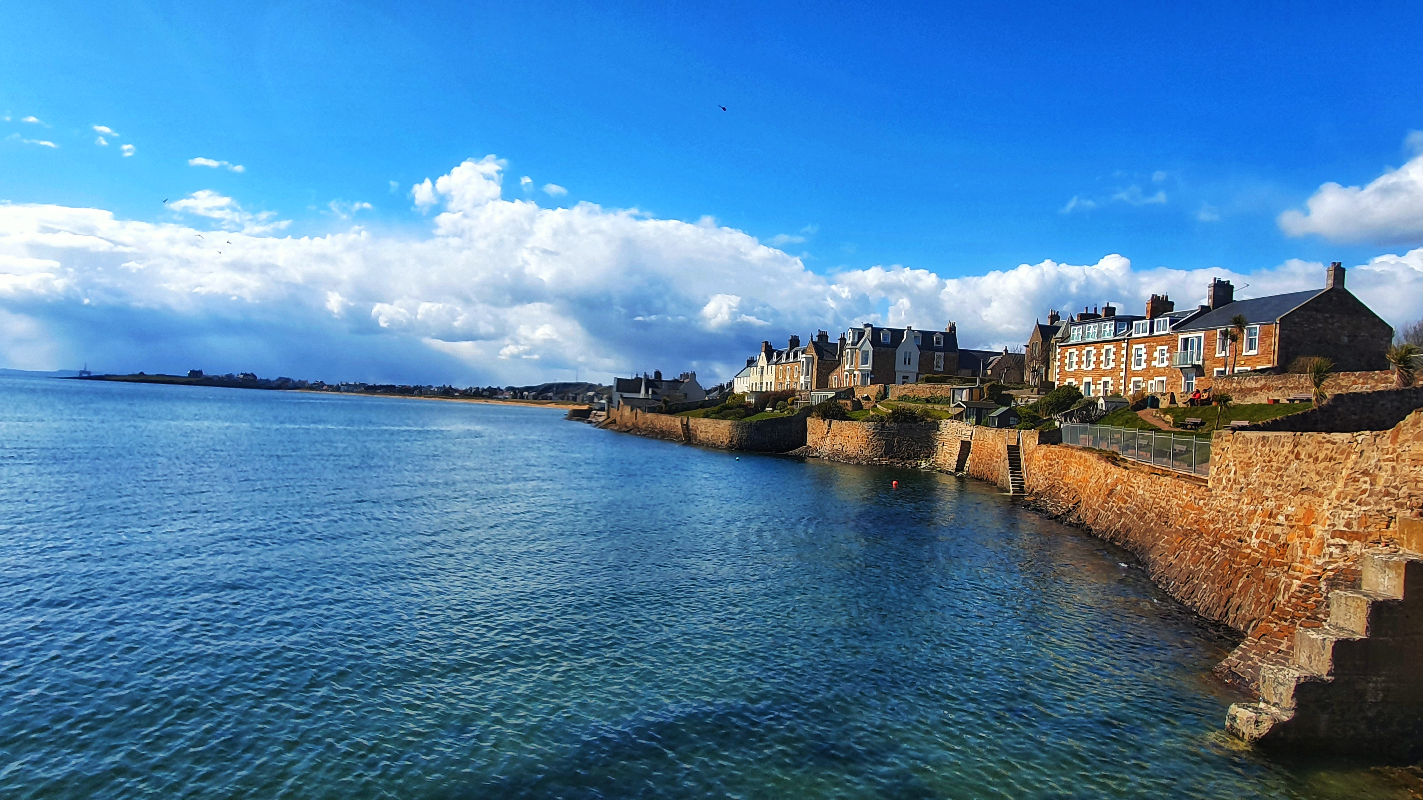
Our first section of the trail left Kincardine Bridge to journey along a mixture of paths, tracks and roads passing through coastal settlements including historic Culross and Rosyth with its giant port and naval base, before reaching the Forth bridges at North Queensferry.
From the bridges we alternated between the rural coastal scenery and settlements including Aberdour finishing for the day in Dalgety Bay.
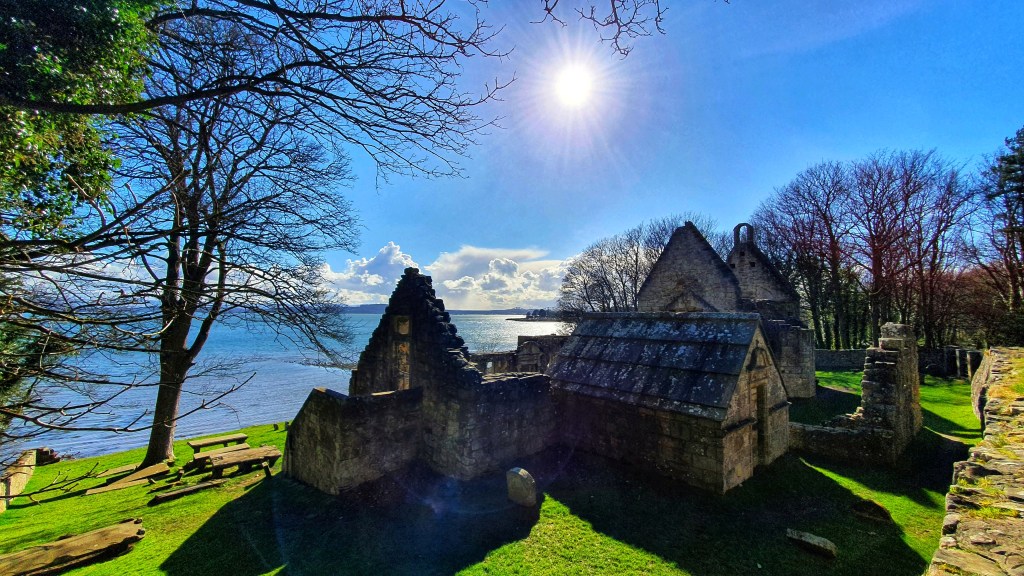
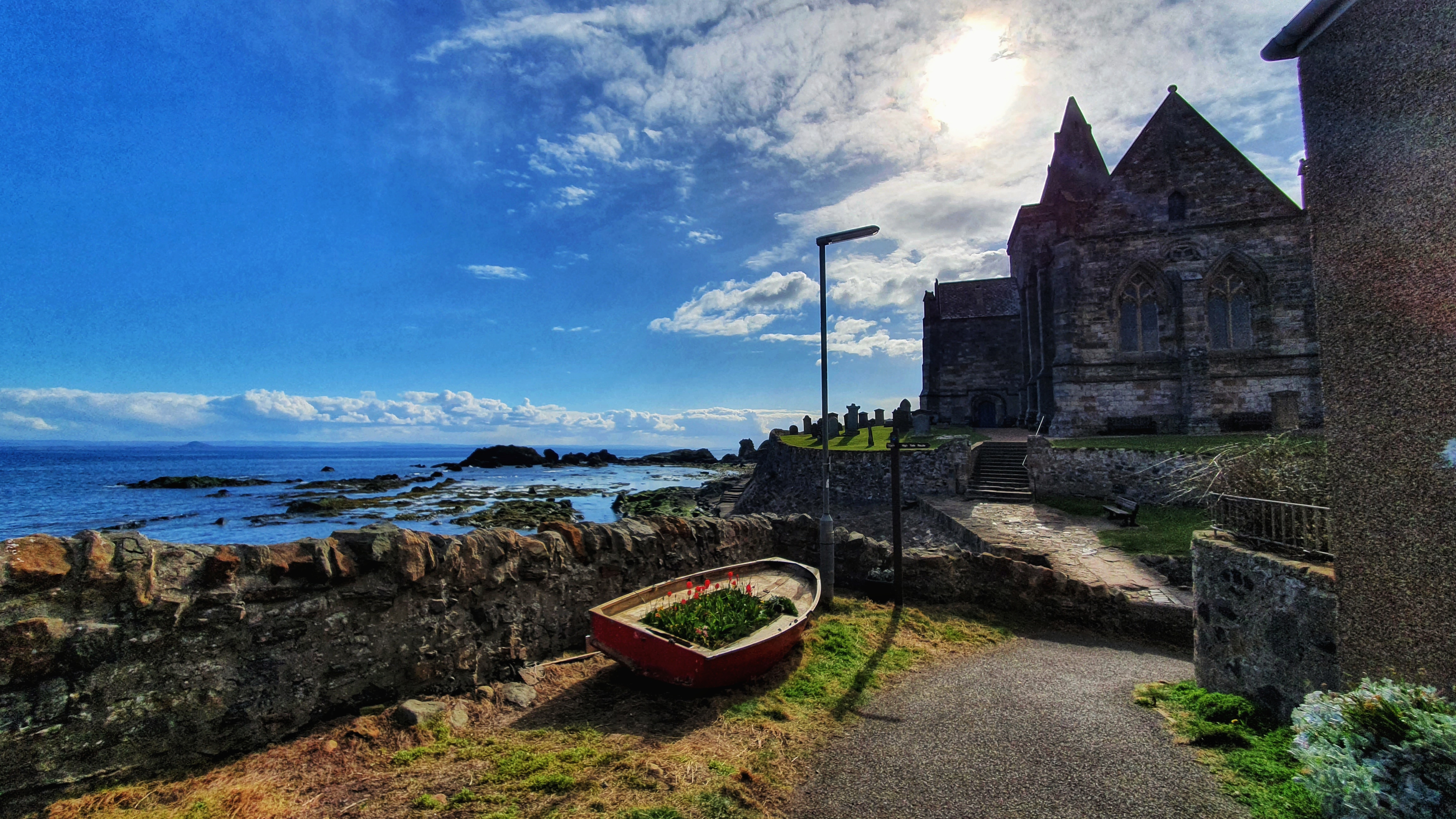
Next day we parked the car at the same spot from the previous night in Dalgety Bay and off we went again. The coastline here was beautiful indeed, we passed by St Bridget’s Kirk, a ruined medieval church, dating back at least as far as 1178 on the outskirts of Dalgelty Bay.
We soon hit Burntisland whereby we spotted a coffee and cake shop doing takeaways. Now this for us was a real treat as usually when we are undertaking adventures we are in the middle of nowhere…so we decided to cease the opportunity and can I just say they had the most amazing fudge yum yums!!!
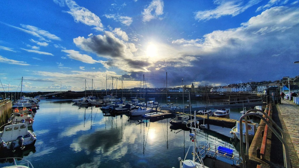
Our sugar rush meant we were soon in Kinghorn, running up the hill to Pettycur Bay, onto Seafield Tower, powering through Kirkcaldy promenade, into Ravenscraig Park, before coming into Dysart, followed by West Wemyss then Lower Largo.
We had only been in Lower Largo a few months back and it was through sending a photo to a relative and her replying casually with, “now there’s a challenge for you, FIfe’s Coastal Path, how long would that take you”…well, the rest is history…here we were, facing another one of her challenges!
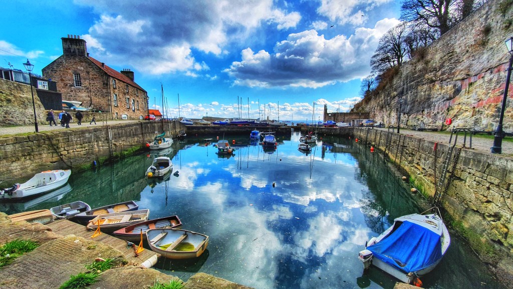
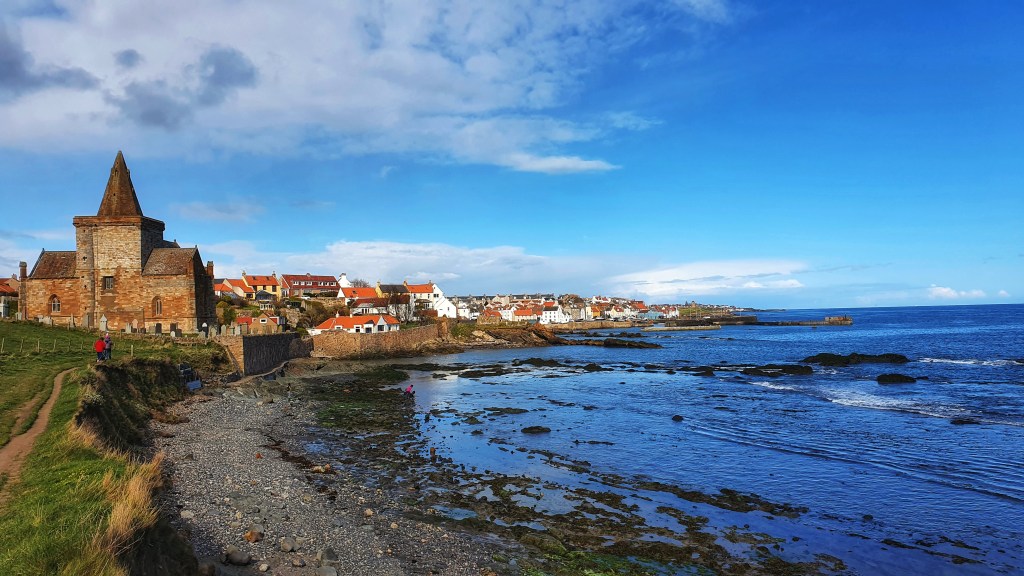
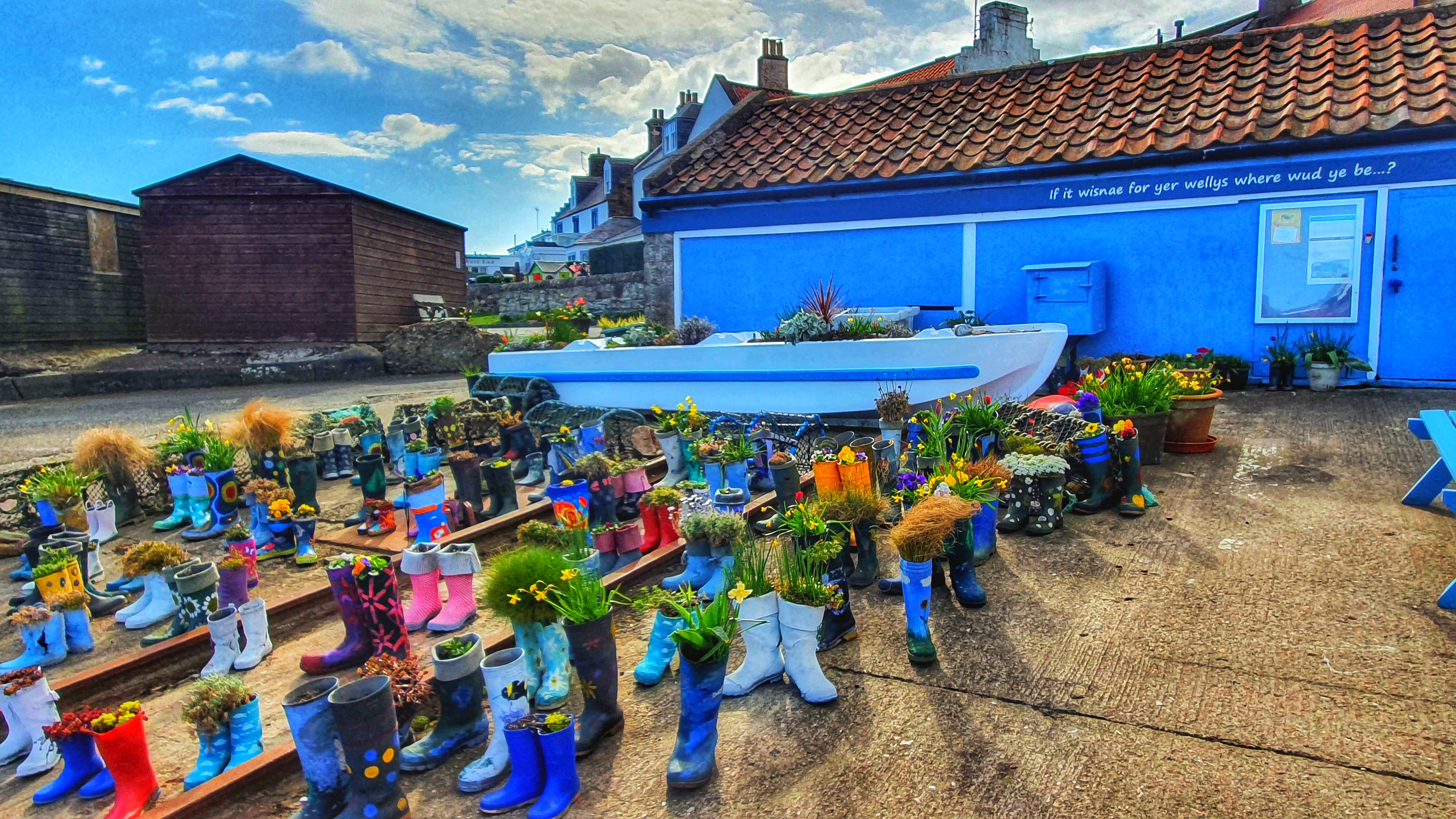
I do love the East Neuk of Fife. You might ask, what on earth is a Neuk? ‘Neuk’ is the old Scots word for ‘corner’or ‘nook’. In this case, the Neuk refers to a collection of fishing villages in the southern tip of Fife. The area covers the villages of Earlsferry, Elie, St Monans, Pittenweim, Anstruther and Crail. All my favourite parts of Fife.
There are some real hidden gems here which nestle amongst the natural harbours along the coastline and are testimony to the heritage of sea-fishing that still lives on in the Kingdom of Fife.
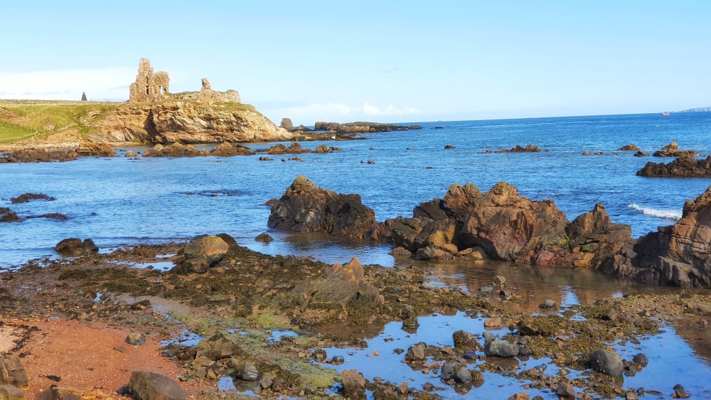
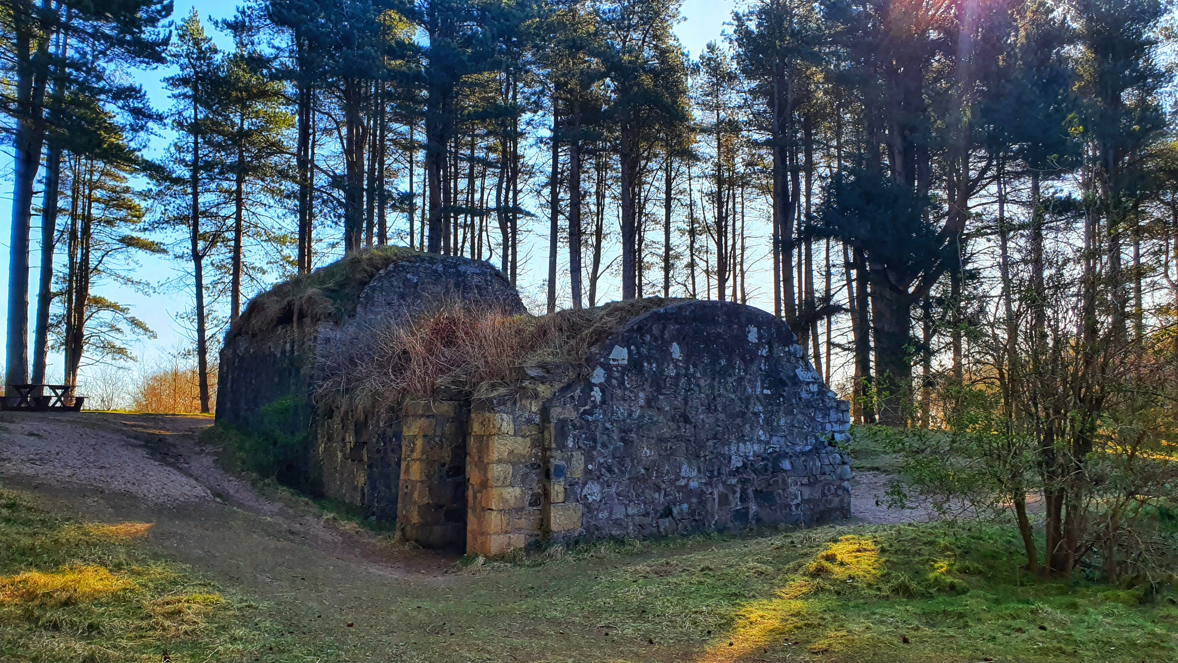
Situated on a craggy clifftop approximately half a mile west of St Monans lie the remains of the once great Newark Castle, a 16th century manor, which though still impressive is now a crumbling ruin. It’s interesting to look around but access is restricted and you need to be extra careful as both the castle and the cliffs are continuing to collapse due to erosion.
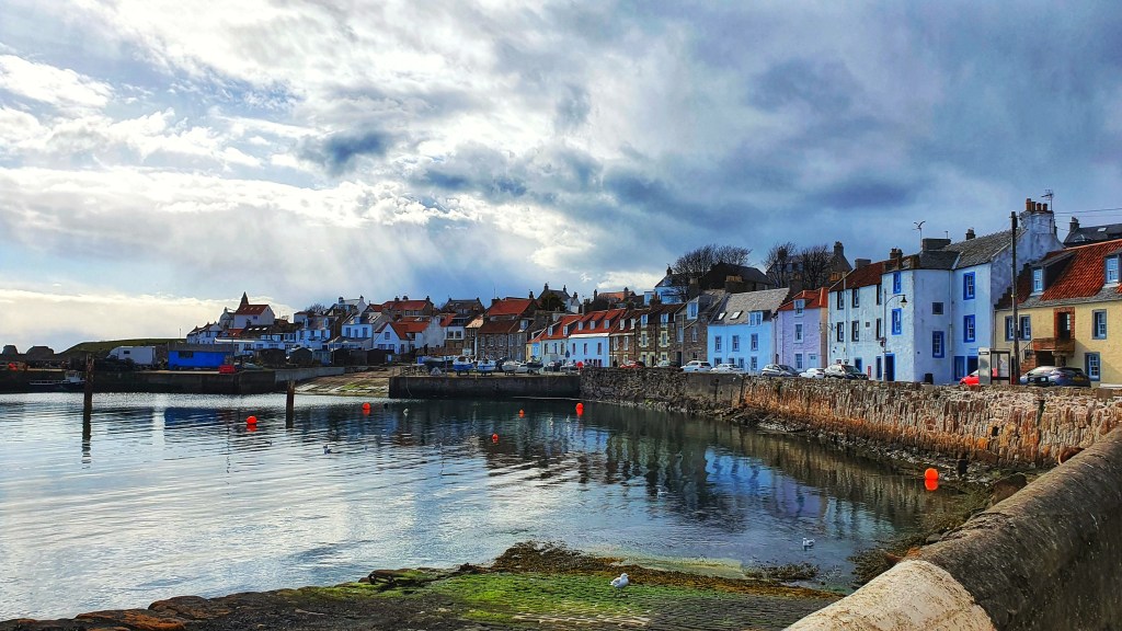
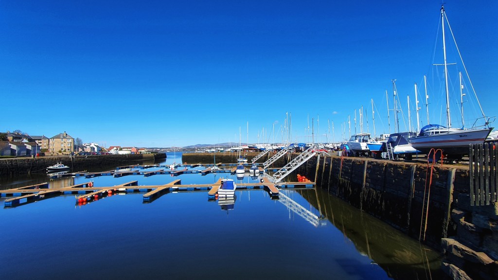
The path continued through the fishing village of Pittenweim which oozes character and charm, it still has an active fishing port and a fish market.
The trail then took us into Anstruther a quaint seaside village with cobbled streets, narrow wynds and a scenic harbour.
We were going to stop here for the famous Anstruther chippie but it appeared everyone else, who by the way, appeared to have came by car, had the same idea…so after us walking miles to get our chippie and being unsuccessful we continued on with empty tummies!
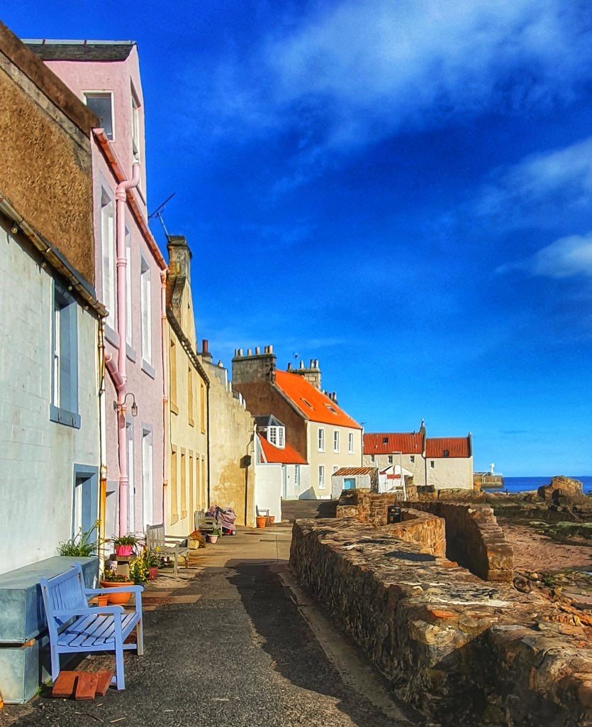
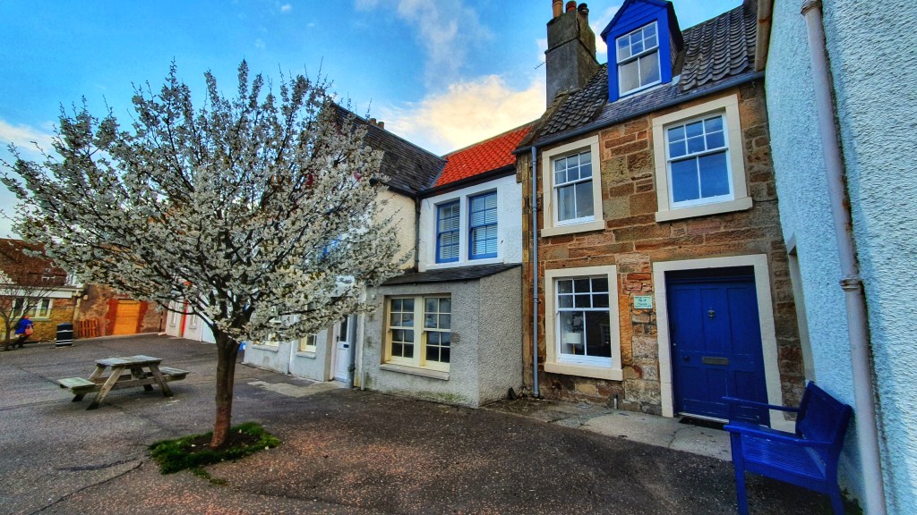
We were then in to Cellardyke a peaceful traditional fishing village with rows of fisherman’s cottages and narrow wynds.
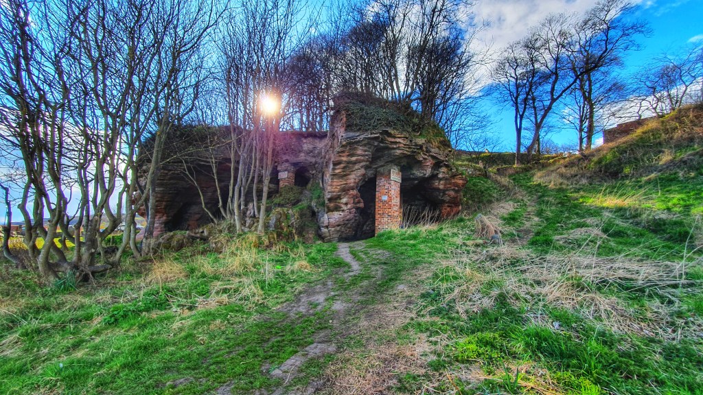
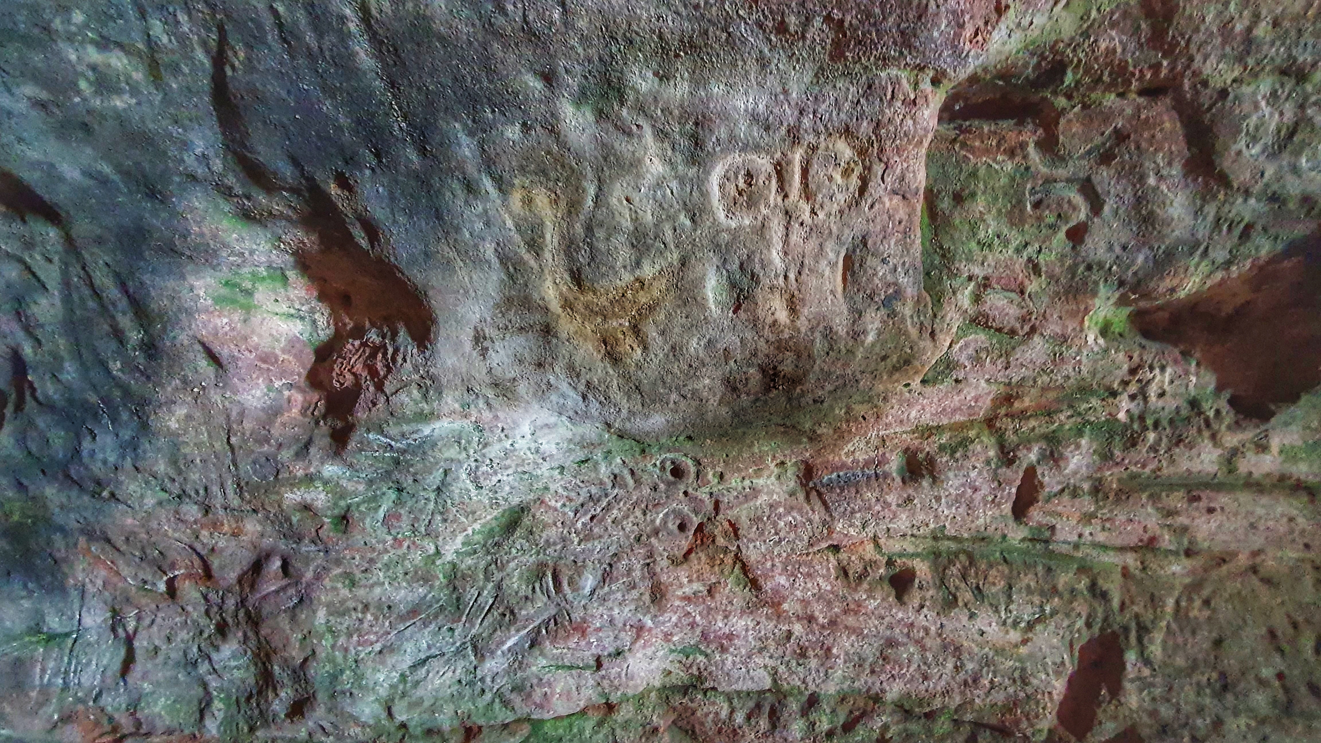
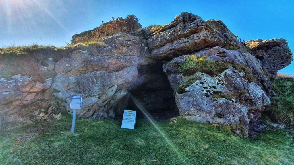
Our minds were quickly taken off the fish and chips when we came across the curious sandstone formations of the Caiplie Caves. These red sandstone structures were cut out by waves in post-glacial times when the lower raised beach was being formed.
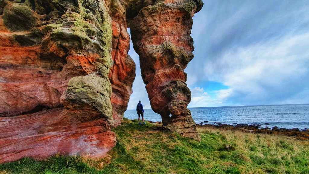
It’s said that these caves have been occupied by humans on and off for hundreds of years. In the 9th century, they were used as sites of Christian worship. Monks and pilgrams en route to St Andrew’s carved crosses in the caves.
One of the caves was then later reportedly occupied by a hermit in the years prior to WWII.
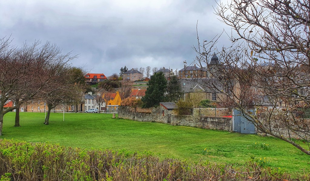
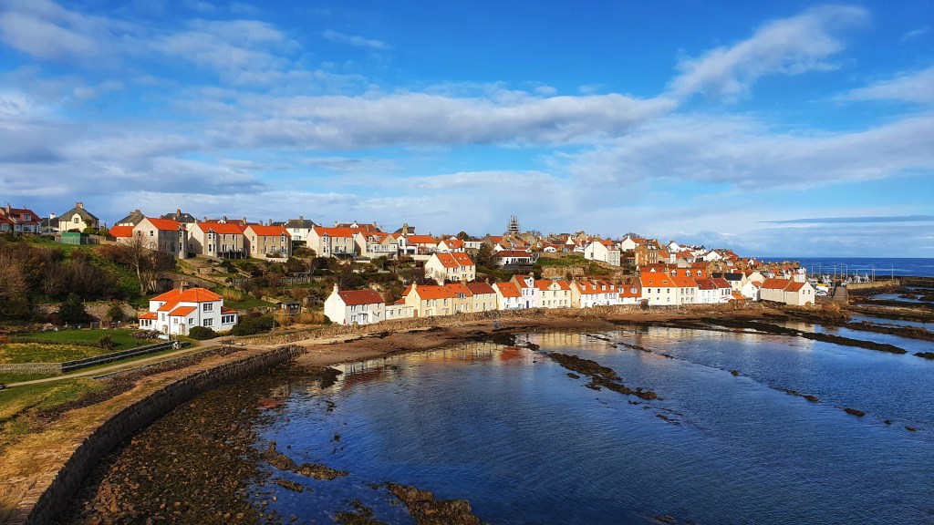
From the caves we were onto our final short walk to Crail which would be our final destination for the day. The town, which is believed to date back to the Pictish period, curls down a slope into the harbour.
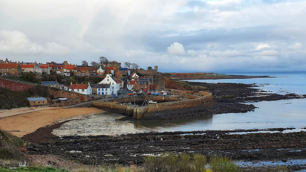
Crail is a lively little harbour town steeped in ancient history and full of character and charm….and it also has a chip shop with no queues unlike what we passed in Anstruther….I meant to take a photo of the fish and chips but only remembered once I finished…they were delicious and well earned!
This section of the Fife Coastal path had been thoroughly enjoyable, each fishing town more charming than the one before.
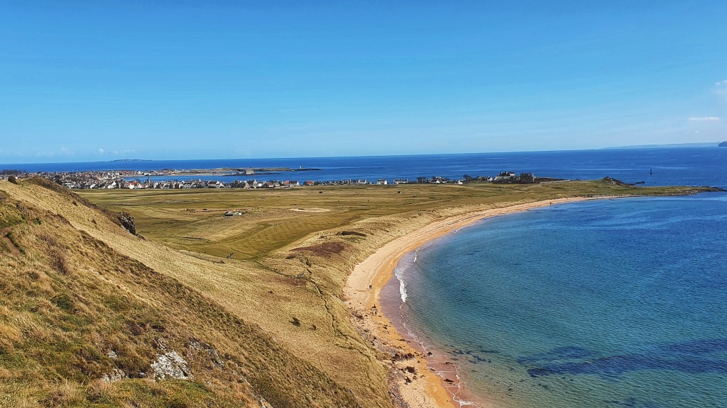
Then, before we knew it we were back in Crail the following day and on our way to Kingsbarns, a lovely little conservation village with one of Scotland’s finest golf courses…infact this whole section took us past so many beautiful golf courses!
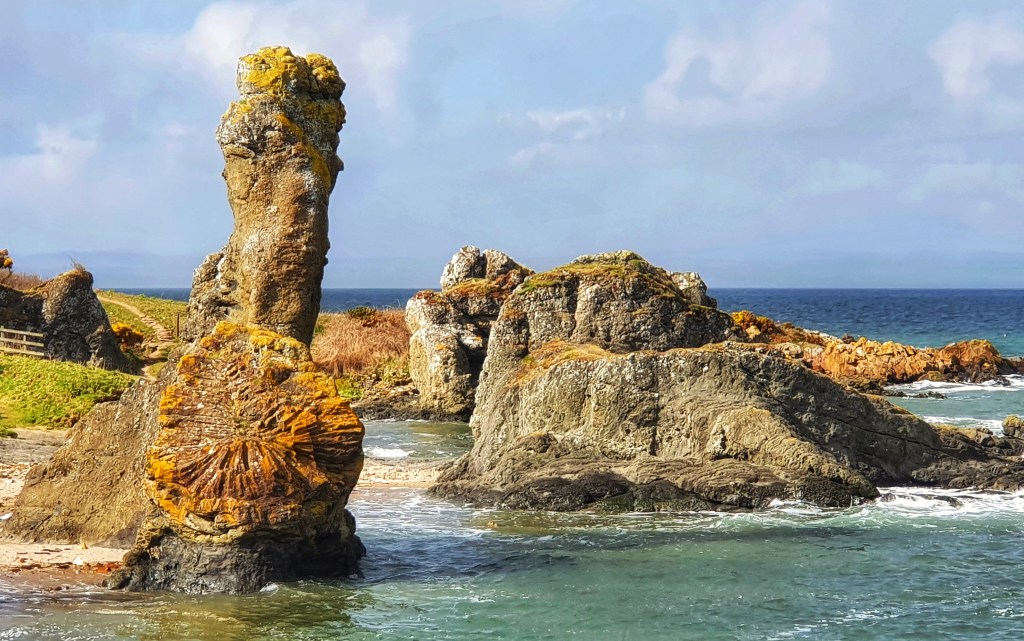
This part of the hike had to be my favourite part overall. It was the remotest part of the Coastal Path, some parts were even impassible at high tide but we had timed it to perfection. We passed by some of the most beautiful spots.
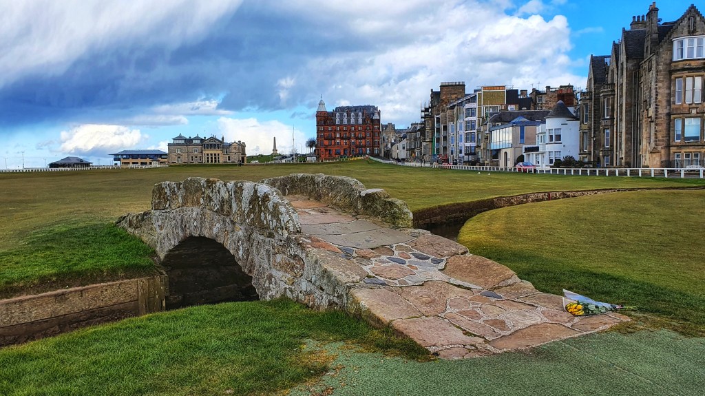
Eventually St Andrew’s came into view in the distance, it still looked such a long way of but at least it was now visible.
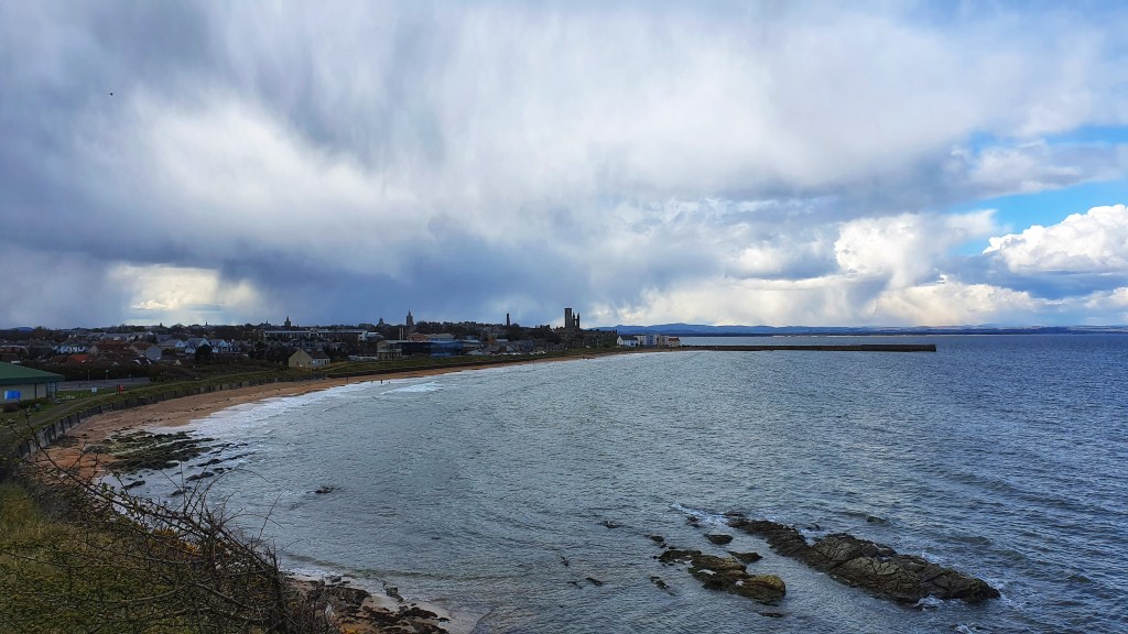
From St Andrew’s Golf Course we began a long stretch along the cycle path heading towards Guardbridge.
Whilst walking this section thoughts began to creep into my head about our final destination for the day which was Tentsmuir Forest. This seemed like it was such a long way away for us to be able to reach it by tonight but we didn’t have a choice as 1 – Our lift was there and 2 – If we didn’t get to this end point tonight it would give us too many miles to undertake tomorrow which was going to be our last day.
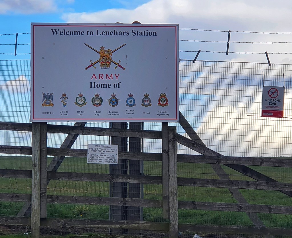
So we plodded on, quickly, until finally reaching Leuchars, then from here the route became attractive once more taking us through Tentsmuir Forest to our final destination for the night….what a relief, we had made it.
And here it was, our final day starting from Tentsmuir Forest with our final destination being Newburgh…we were on our final stretch of the coastal path. I’m always quite sad when things like this come to an end as I feel long distance hiking gives me purpose and something to focus on, however I guess there’s then the excitement of completing the challenge and all the feelings that brings.
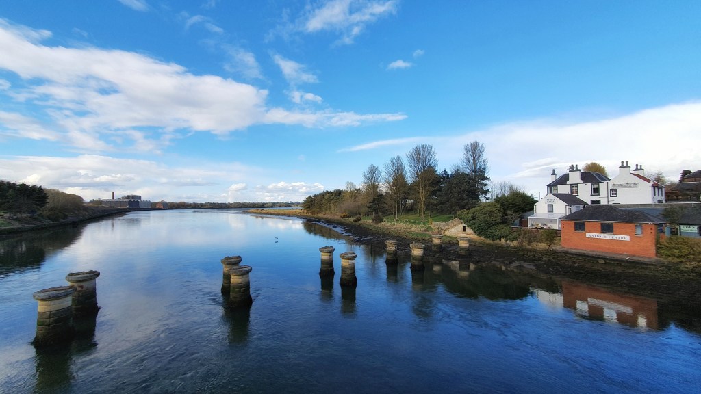
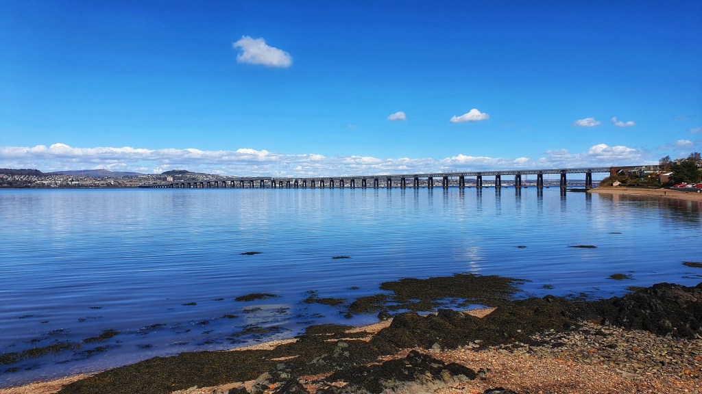
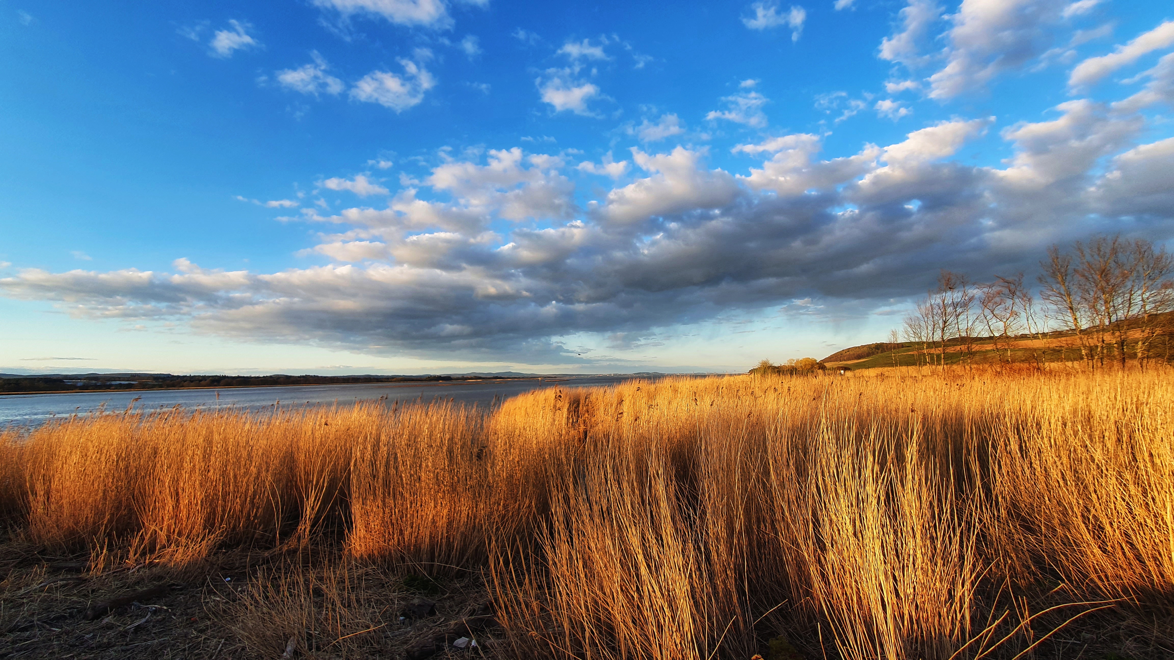
Tentsmuir Forest is pretty big and it felt like a long long walk through it until we finally reached Tayport with it’s pretty little harbour. We could see across to Dundee and Broughtyferry.
Then we were into Newport, Wormit Balmarino and finally Newburgh.
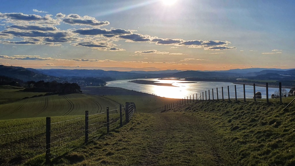
The section between Wormit and Newburgh was scenic however it did take us more inland after Balmarino and we lost sight of the coast for quite a bit but it was very beautiful all the same.
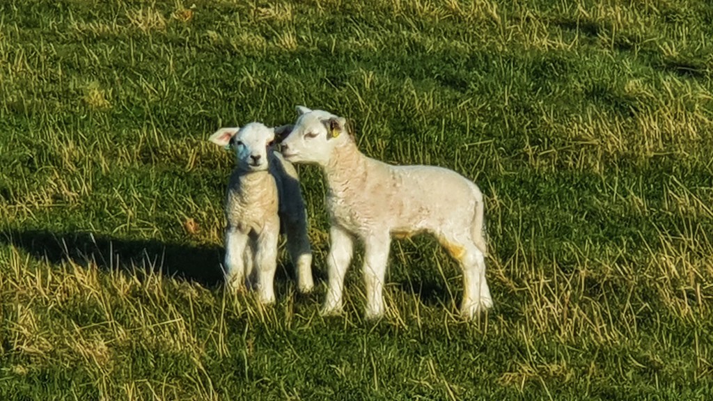
The countryside at this point was peaceful and quiet, the sun was shining, although still cold, but it made the landscape look beautiful. The lambs were in the fields, it was idyllic and a perfect end to a perfect walk.
Eventually the sea came back into view and low and below Newburgh could also been seen in the distance….we were almost there.
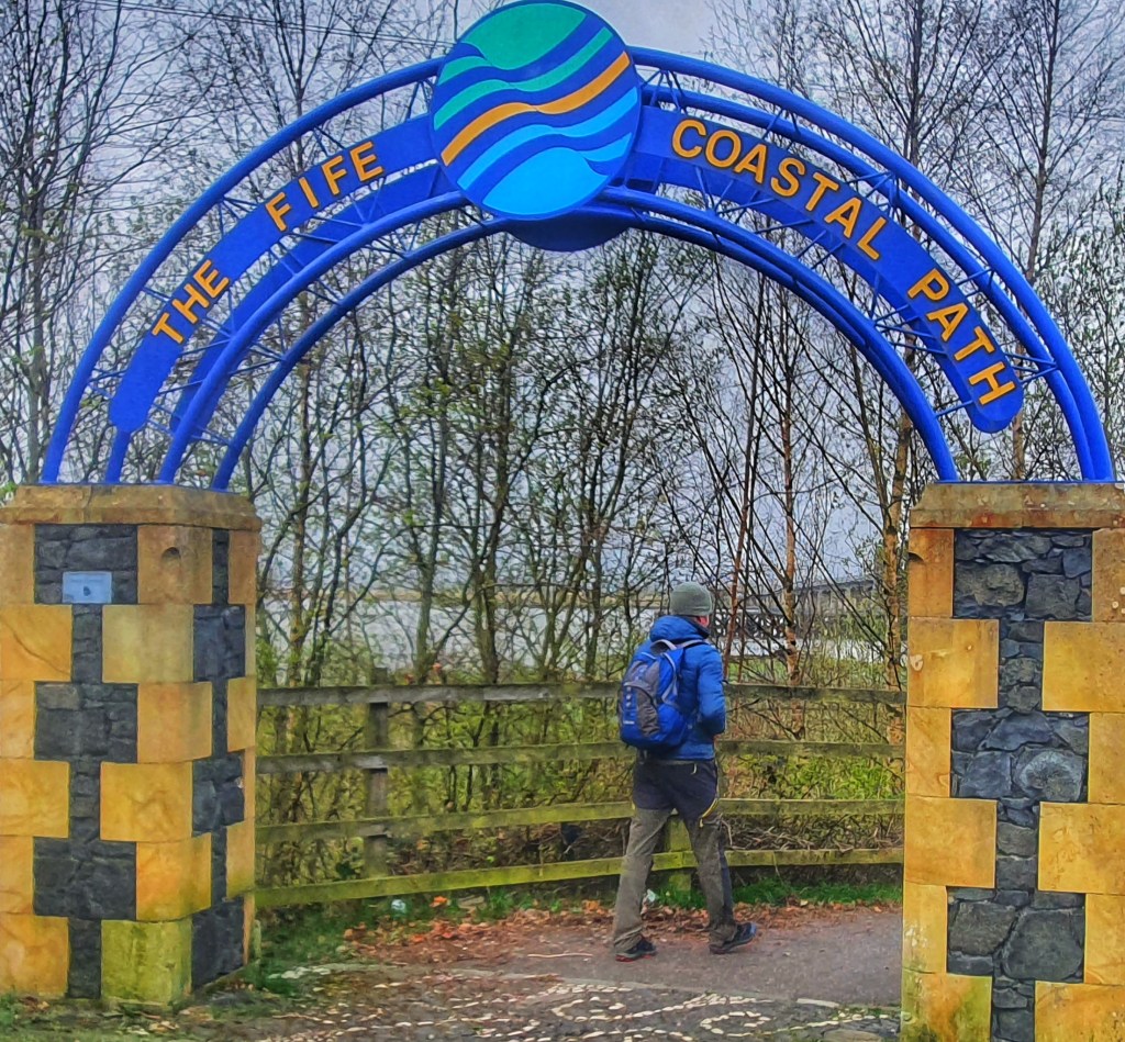
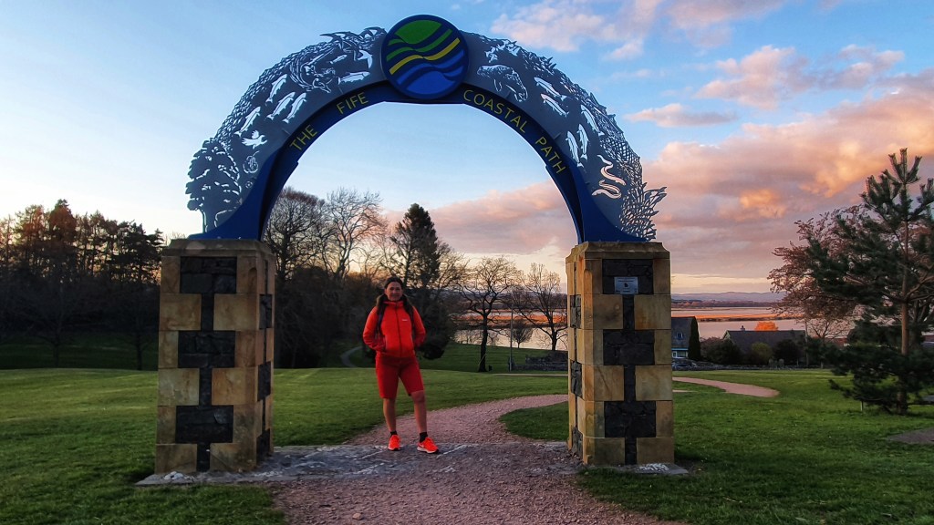
Making our way off the hill we eventually entered the village, passing the harbour, where we thought the end of the walk should have finished but ow no, we had to walk some more, and followed the signs which led us up through a park and there stood the arch – FIfe’s Coastal Path, Newburgh! We had made it!
What an amazing local long distance hike this had been right on our doorstep. It had spectacular sea views, craggy clifftops, expansive sandy beaches, quaint fishing villages, abundant wildlife and historic sites we really couldn’t have asked for more.

The sights along the way had been breath-taking and before we knew it we had walked 10, 20, 30, 125 miles without realising and enjoyed every single minute.
125 miles was our final milage count, the route description states 117 miles in total. We stuck to the route so we are as confused as you are but we tracked it so that’s our final figure.
I would highly recommend this hike and like any other hikes we’ve done there’s more enjoyable parts than others especially the more remote parts but that’s just me!
Quite possibly if it had not been for lockdown we would never have undertaken this walk so there’s at least one positive to come out of all this! Fife Coastal Path you were awesome!
